

Geospatial intelligence from every unmanned system, in minutes.
Ingest, process, run AI models on, and share UAS data across every echelon from one browser workspace. Any sensor. Any platform. Anywhere.
How it works
From sensor to insight in four steps
One automated workflow takes data from the aircraft to every decision-maker who needs it.
Capture and upload
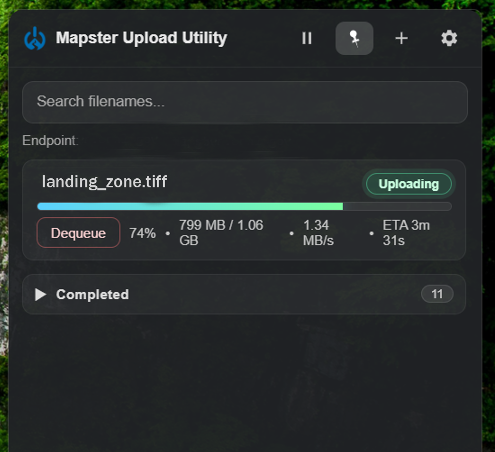
Fly any UAS. The lightweight MAPSTER Upload Utility sends your data to the map within seconds of landing, even on limited communications networks.
Process automatically
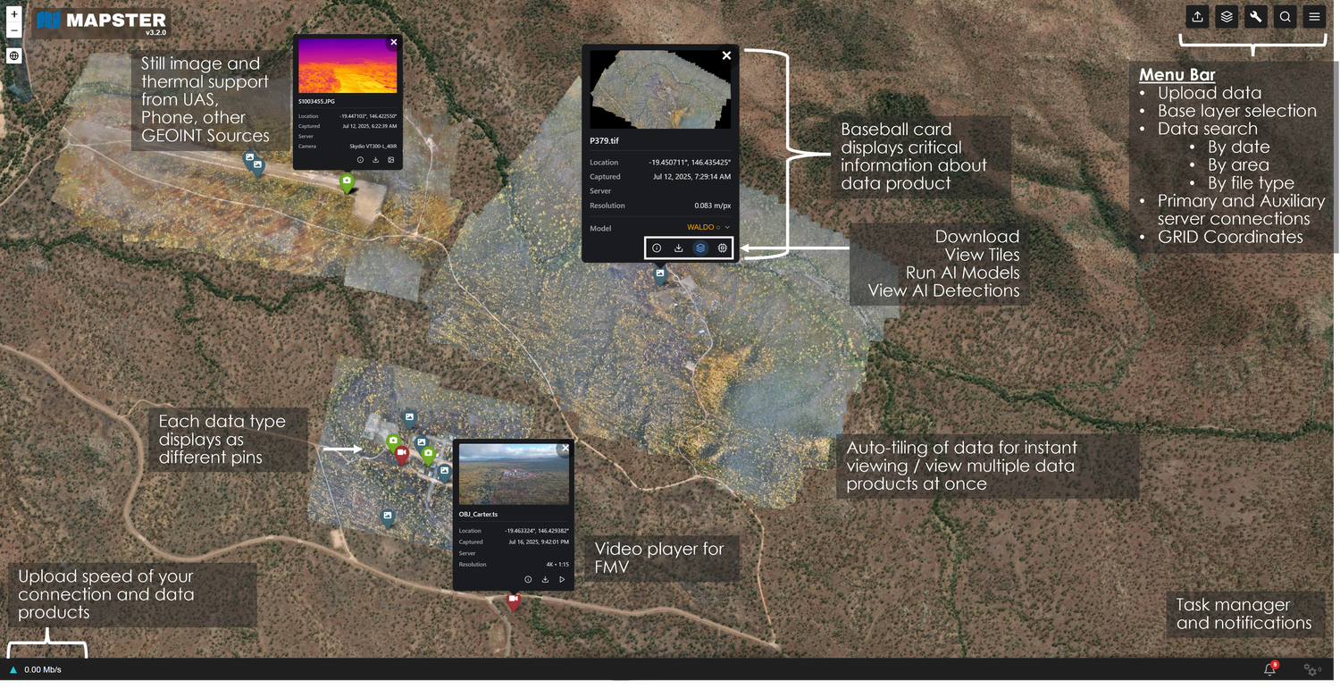
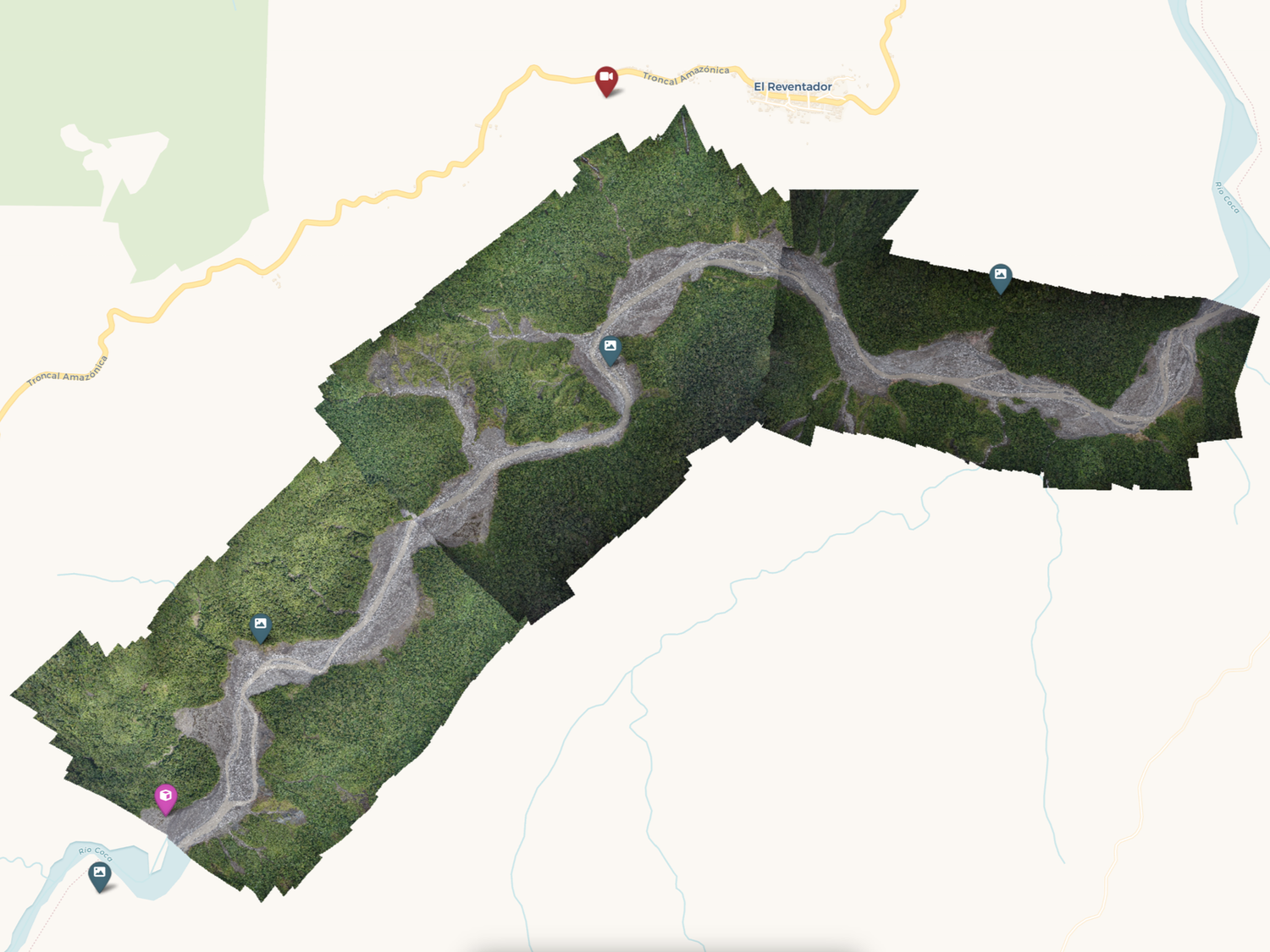
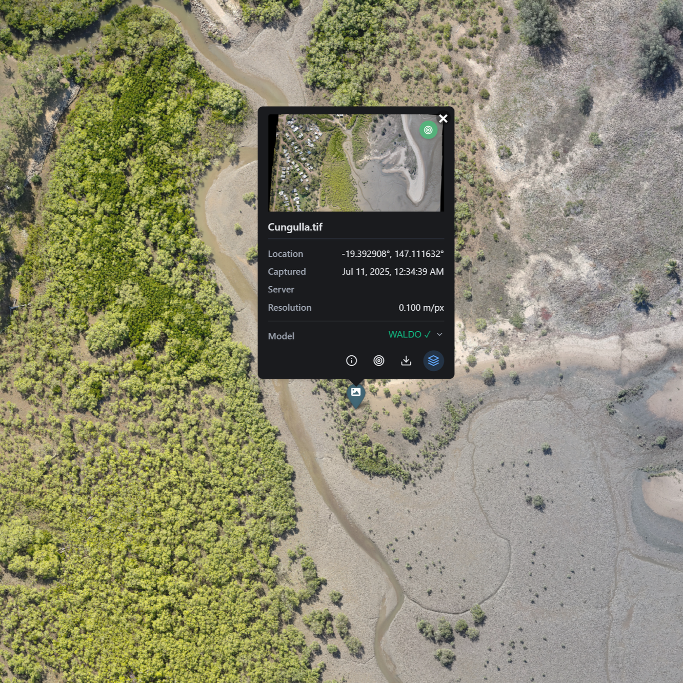
Use your own processing software or let MAPSTER standardize imagery into 2D, 3D and DSM products, auto-tiled for instant viewing in the browser.
Analyze with AI
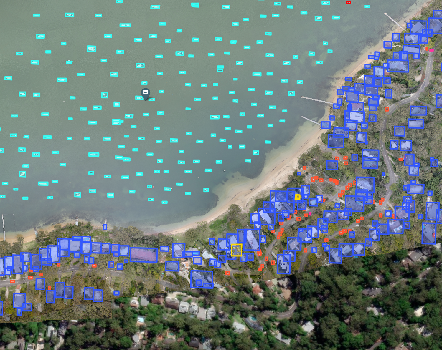
Pre-built AI models run on every upload for fast detections. Have your own model? Host it in MAPSTER and run it against your data.
Share and respond
Every data product carries a metadata baseball card. Share across your organization or between agencies in minutes, and get alerted when new data lands in your area.
MAPSTER capabilities
Everything your team needs, nothing it has to install
AI detections
Pre-built models run automatically on every upload, or bring your own.
Built for the edge
Uploads that keep moving on limited and degraded networks.
2D, 3D and DSM processing
Standardized data products without separate processing software.
API, webhooks and alerts
Feed your common operating picture and get notified by location.
Any unmanned system, any sensor
Platform agnostic across every UAS type and manufacturer, plus phones.
Full-motion video in the browser
Play FMV right on the map, alongside your imagery.
Supported files: .TIFF (2D ortho and DSM) · .JPEG · .MP4 · .MOV · .TS · .LAS · .LAZ
Who we serve
Built for organizations that decide with unmanned system data
Federal government
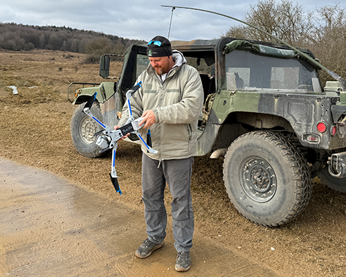
Department of War, FEMA, the Department of Homeland Security and Customs and Border Protection.

State and local
Emergency management services, energy and infrastructure organizations.
Private sector
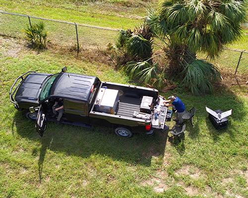
GIS providers, unmanned system manufacturers and businesses across the UAS industry.
Plans and options
An option that fits how you operate
Every option includes the full MAPSTER platform and 500 GB of data ingest. Published pricing is coming soon. Request a quote today.
Individual
For analysts and operators who collect, process and analyze their own UAS data.
Pricing coming soon
- Automatic 2D and 3D data processing
- Tiled imagery viewing
- Upload and download data products
- Load your own AI models
- Run AI models against your imagery
- 500 GB of data ingest
Enterprise
For agencies and organizations with custom scale, sharing or deployment needs.
Custom quote
Request a Custom QuoteAdd to any plan
Expert support
Consulting
Optimize your unmanned system workflows and data strategy.
Data Analysis
Processing, in-depth analysis and organization of your GEOINT.
Training
Tailored programs that get your teams operational fast.

Who we are
Forged in Army Special Forces. Proven in operations.
Tri-Bolt Technologies brings 25 years of mission execution, tactical precision and critical thinking to the private sector, bridging the gap between every level of government.

Michael Shellenberger
CEO and Founder. 20 years as an Army Special Forces Green Beret. B.S. in Strategic Studies, Norwich University.
FAQ
Frequently asked questions
Which unmanned systems and sensors does MAPSTER support?
MAPSTER is platform agnostic. It works with every UAS type and manufacturer, and also accepts imagery from phones and other GEOINT sources.
What file types can I upload?
2D orthomosaics and DSMs as .TIFF, still images as .JPEG, video as .MP4, .MOV and .TS, and point clouds as .LAS and .LAZ.
Does it work on limited or degraded networks?
Yes. The MAPSTER Upload Utility uses a unique data sending method so data reaches the map within seconds, even on limited communications networks.
Can we run our own AI models?
Yes. Upload your model to MAPSTER and it runs against your data alongside the pre-built detection models.
Can MAPSTER run inside our own environment?
Yes. A Dedicated Deployment runs MAPSTER in your cloud or on-premises. Contact us to scope your requirements.
Ready to Learn How We Can Revolutionize Your Unmanned System Operations?
See firsthand how Tri-Bolt Technologies can transform your operational intelligence. Schedule a personalized demo with our team today by using the form below or calling: