
Multi-platform, Automated, Processing, Storage, Tasking, Exploitation, and Retrieval
From Sensor to Insight - Automated Geospatial Intelligence in Minutes
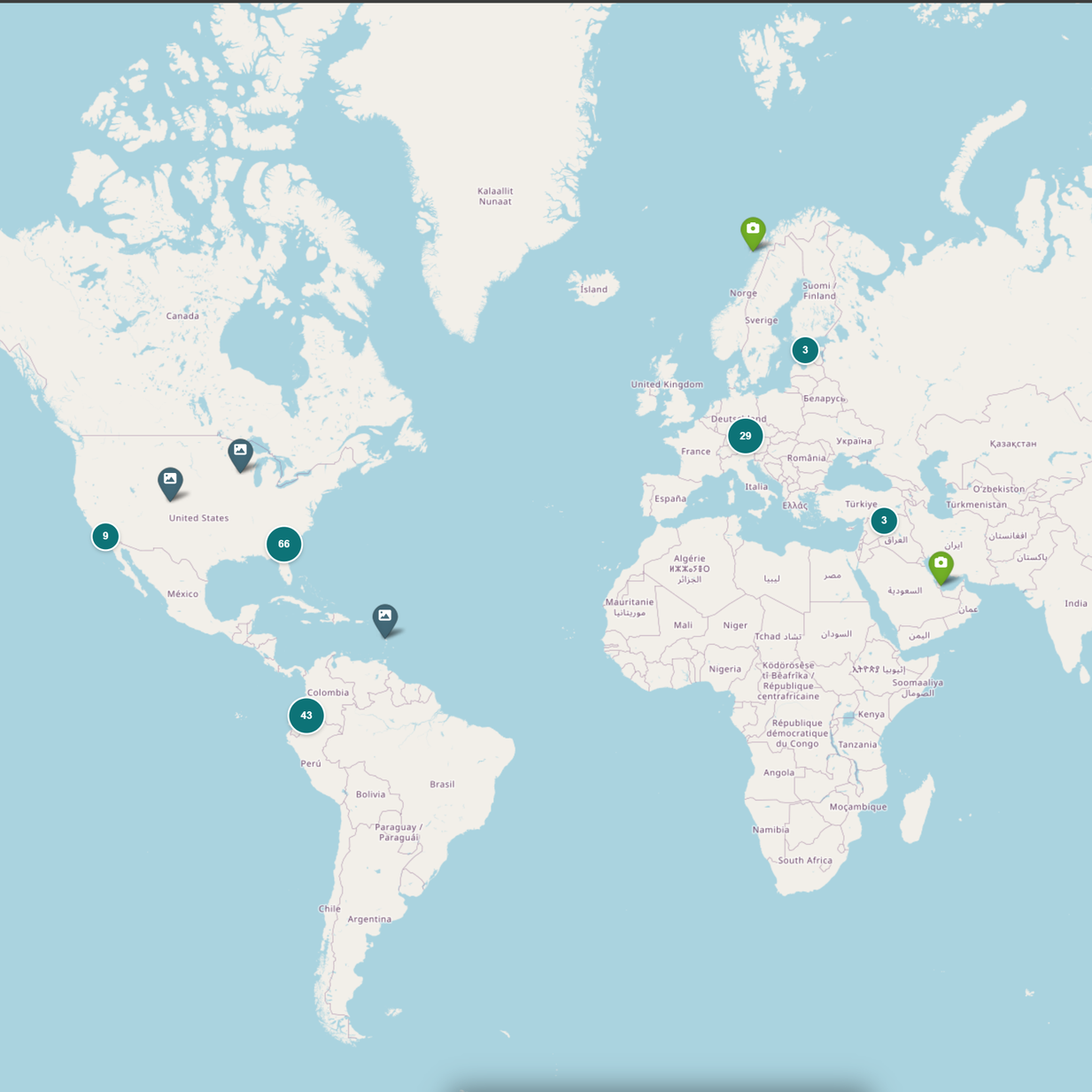
All of your UAS data in one place.
Any sensor.
Any platform.
Anywhere.
Automated Geospatial Workflow

Capture
Collect data with any UAS as MAPSTER software is platform agnostic. Your data is automatically uploaded to the system after flight.
Process
Process your imagery with your own software or process on our system for standardized data
Analyze
Automatically run AI models against your imagery for actionable intelligence
Share
Easily share data within your organization or between agencies within minutes

Respond
Enables rapid incident response by turning field-collected data into actionable geospatial intelligence in near real-time
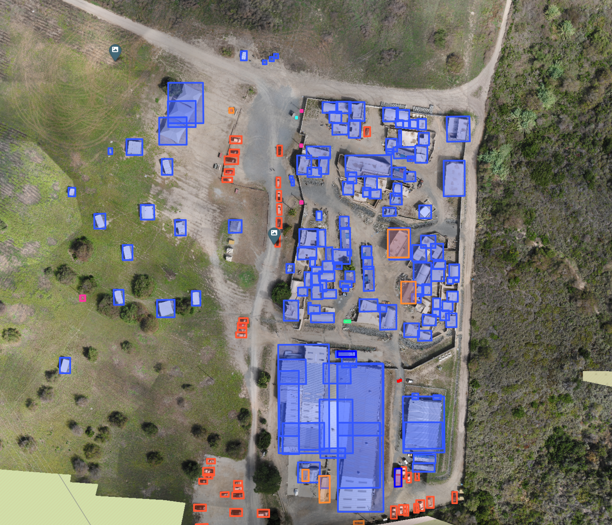
Pre-built AI Models
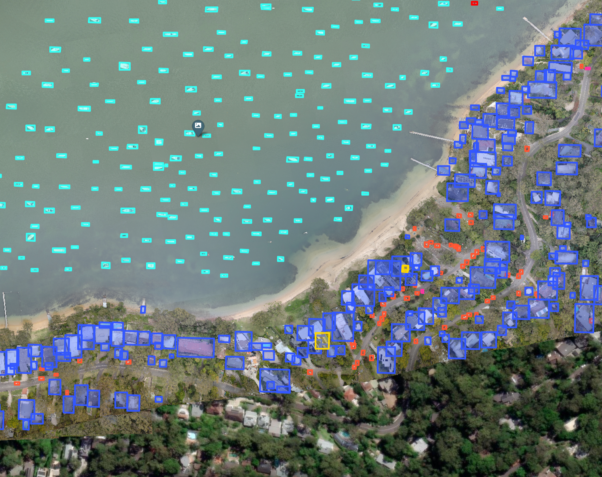
MAPSTER includes pre-built AI models that automatically run on your uploaded imagery for fast analytics and detections
Upload Your Own AI Model
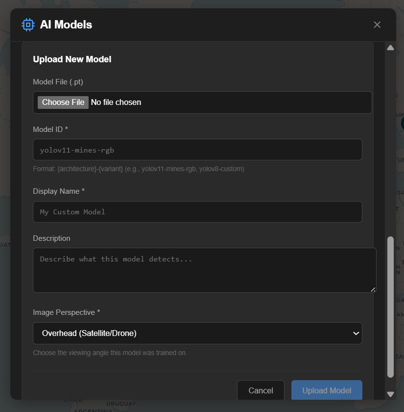
Have an AI model that you want to run on your data? MAPSTER makes it easy to host your own AI model to seamlessly run against your data.
API and Data Notifications
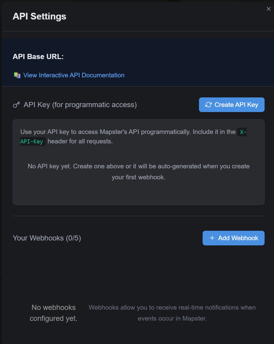
Pull data into 3rd party software or Common Operating Platform for further analysis and exploitation. Receive notifications of new data in MAPSTER based on location.
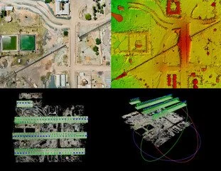
Processing into 2D, 3D, DSM Data Products
Don’t have your own UAS processing software? Use MAPSTER to standardize your processing workflow into 2D, 3D and DSM data products.
Lightweight Windows Application
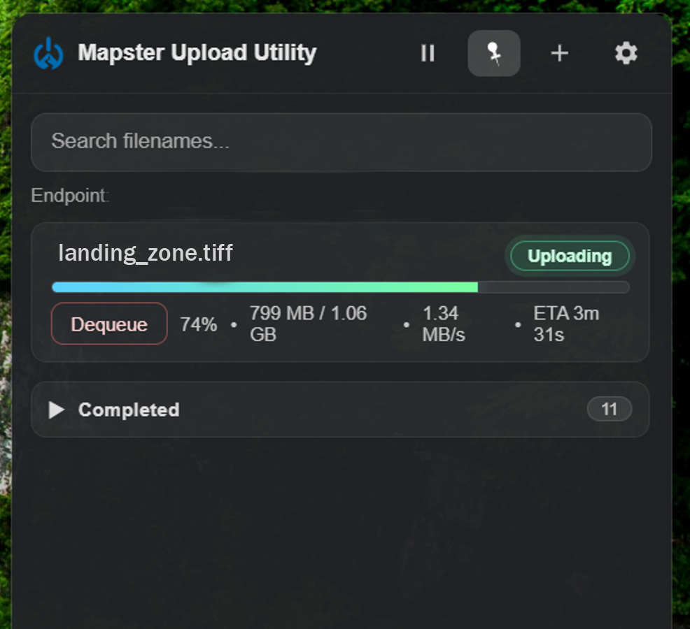
The MAPSTER Upload Utility automatically uploads your data to MAPSTER and displays within seconds on the map even in a limited communications network with our unique data sending method.
UAS Platform Agnostic
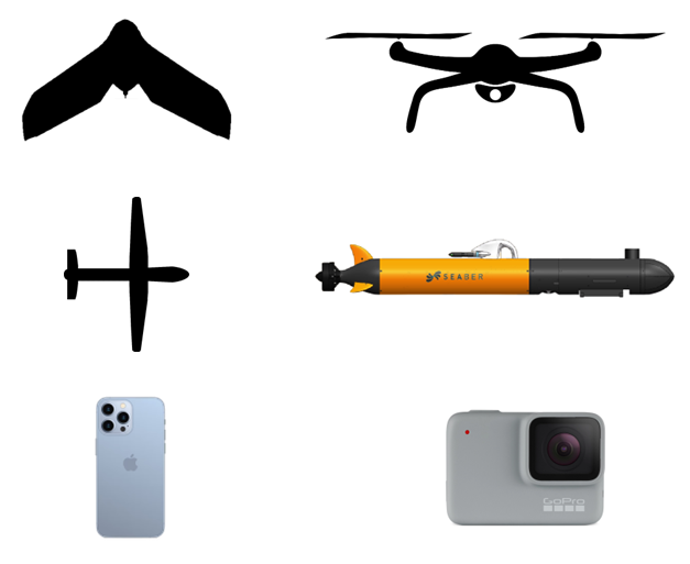
MAPSTER works with all UAS drone types and manufacturers
Supported File Types
.TIFF (2D Ortho)
.JPEG
.TIFF (DSM)
.MP4
.LAS
.LAZ
.TS
.MOV
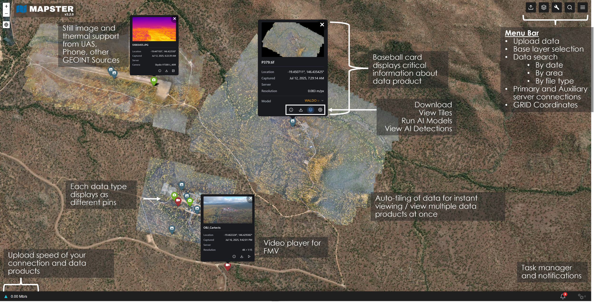
Information Baseball Card
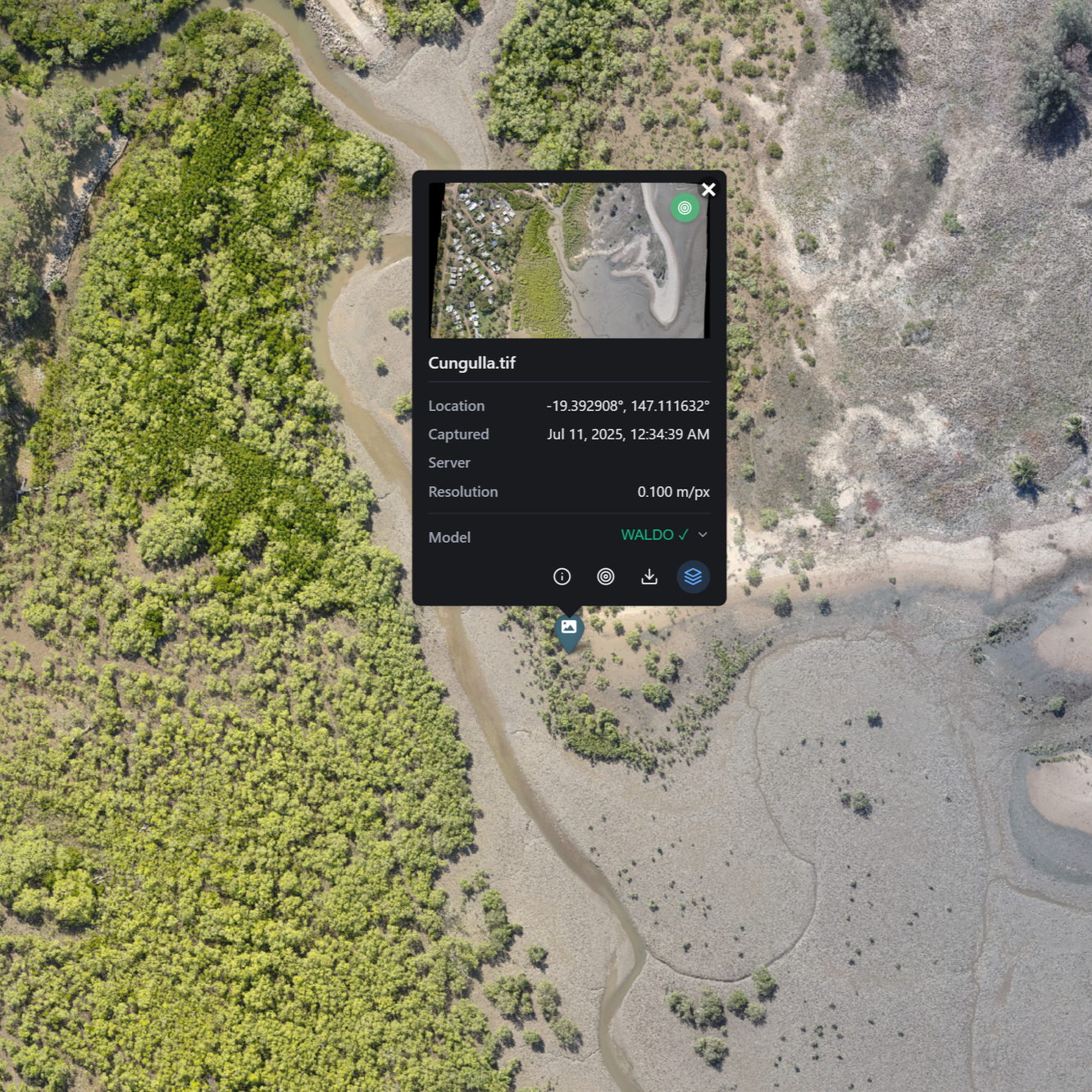
Each data product has a baseball card which gives critical information and metadata about the data
In Browser Video Player
Play FMV directly in your web-browser
Auto-Tiling of Data
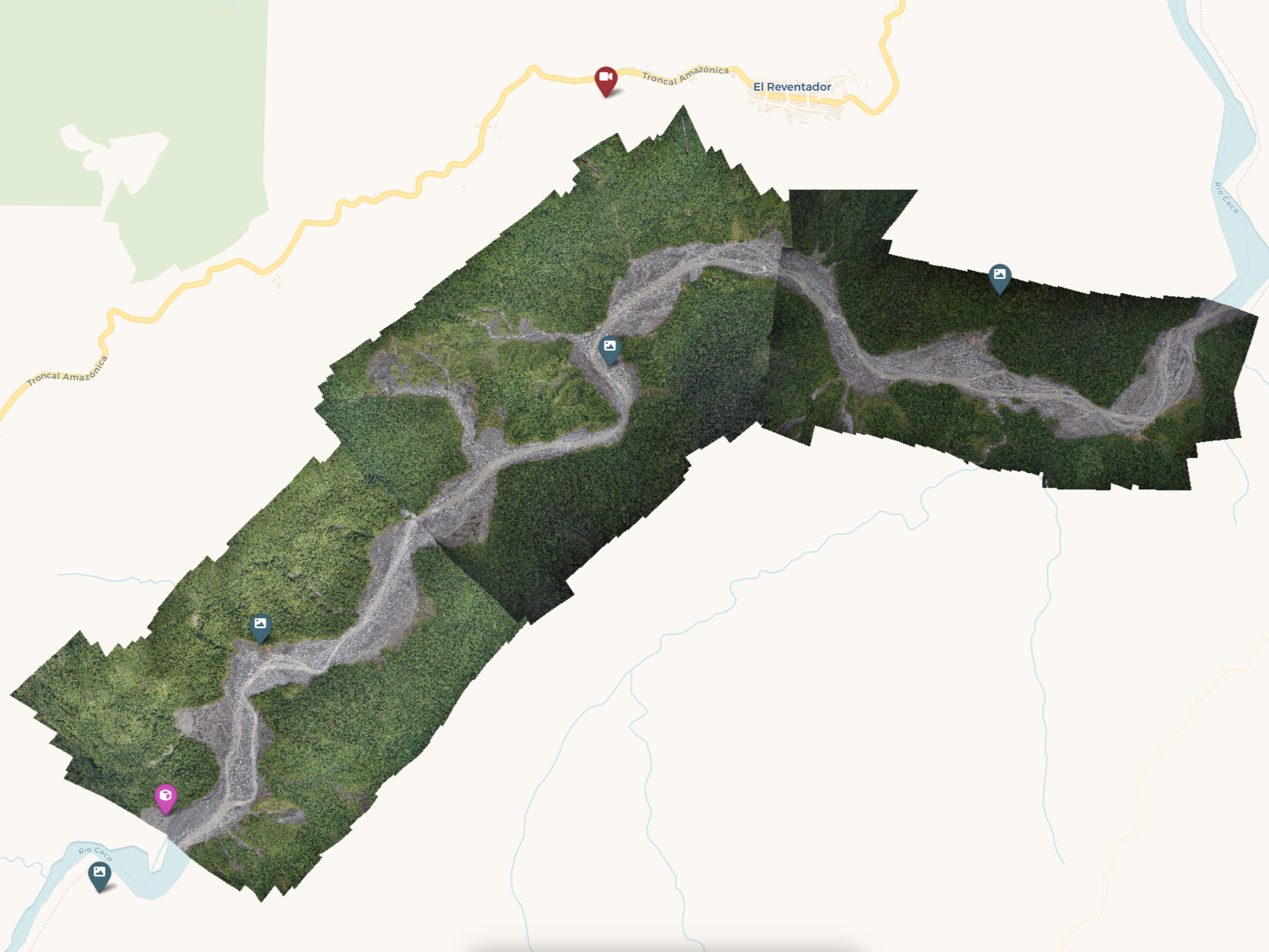
MAPSTER automatically tiles 2D data for easy viewing within a web-browser making it easy to view your data. Display multiple data products at once for a wholistic view of your data site.
Schedule a Demo
Contact us to schedule a demo to see how MAPSTER can work for you and simplify your workflow and data management!